Reading the Rock: How the Real Blue John Canyon Maps onto Britain's Own Rugged Ground
Danny Boyle's 127 Hours is unmistakably American. The slot canyons of Utah's Canyonlands country, the red sandstone, the vast desert horizon — none of it exists in Britain. And yet a curious thing happens whenever the film plays to a UK audience: seasoned hillwalkers lean forward, not because the landscape is foreign, but because the logic of it feels utterly familiar. The narrowness. The remoteness that is only ever forty minutes from a car park. The complacency of a solo traveller who knows the ground but not its mood.
This is a film about geography as much as psychology, and it is worth reading that geography through a British lens.
The Anatomy of a Slot Canyon
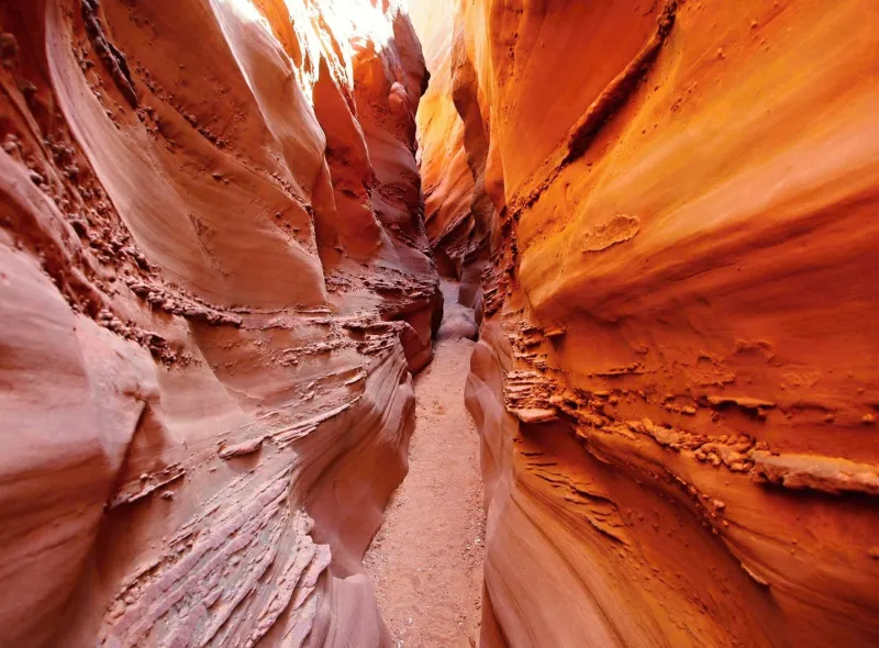
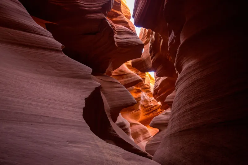
Blue John Canyon (the film's real-world setting, reached via the trailhead at Horseshoe Canyon in the Canyonlands district) is what geomorphologists call a slot: a drainage channel cut into soft Entrada and Navajo sandstone, sometimes barely a metre wide and tens of metres deep. The walls curve inward at the top, so that midday light reaches the floor only in narrow beams. Water did the carving, flash-flood by flash-flood, over millennia.
The crucial detail for British readers is this: slots like Blue John are not wilderness in the expeditionary sense. They sit within day-hiking distance of sealed roads, and mobile signal fails not because of distance but because of the rock walls themselves. Aron Ralston was, in practical terms, close to help. He simply could not reach it, and no one knew where to look.
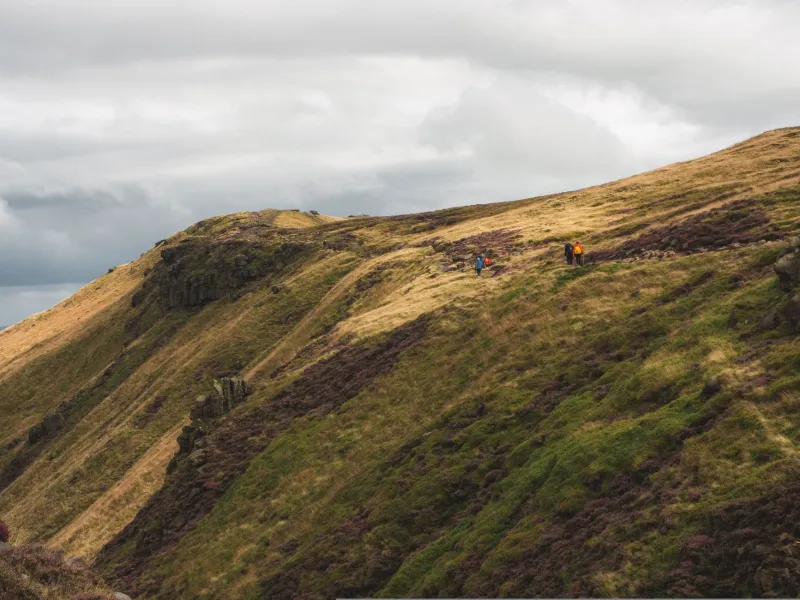
Compare that with the UK's own terrain of deceptive proximity. The Kinder Downfall area, the remoter cwms of Cwm Idwal, the back of Glencoe beyond the A82 — all are places where a walker can be an hour from a village and yet effectively invisible to it. British ground does not need desert scale to produce the same isolation. It needs only weather, poor light, and one wrong decision.
What the Film Gets Right About Scale
Boyle, working with cinematographer Enrique Chediak, shot largely in the real canyons of southern Utah rather than on stages, and the topographical fidelity shows. Watch the sequence of Ralston pedalling out at dawn: the road narrows, the mesa walls rise, and the frame tightens in step with the geology. The camera's claustrophobia is not a stylistic imposition; it is the canyon itself, reproduced faithfully.
The boulder that traps him is a chockstone — a block wedged in a slot by floodwater, a genuinely common hazard in this terrain. British equivalents exist in miniature: the jammed boulders of gully exits on Scottish mountains, the choked ravines of the Yorkshire dales. Anyone who has descended a narrow gill in the Lakes, wedged between wet rock with the exit above them, has felt a faint, safe echo of what the film renders in full.
The British Palette Problem — and Boyle's Solution
Here is where the visual geography becomes genuinely interesting. Utah sandstone is orange and red; British rock is grey, green and brown. The film could not look more different from a Lake District ridge on an overcast afternoon. And yet Boyle's colour grading — the saturated teals, the sun-bleached ambers, the almost hyperreal glow he favoured during his palette experiments across his career — does something subtle. It abstracts the landscape into light and shadow rather than hue.
Strip the colour out and the geometry maps directly onto British ground: the steep-sided ravines of the Black Cuillin, the slot-like gorges of the Brecon Beacons' waterfalls country at Ystradfellte, even the sandstone crags of the Peak's Roaches, where wind-carved hollows pinch the light in a manner that would not look out of place in a Boyle frame. The film's canyon feels British not because it resembles Britain, but because it behaves like Britain: intimate, enclosing, and indifferent.
Planning the Walk the Film Inspires
For UK readers moved to lace up boots after watching, the sensible translation is not a flight to Moab but a re-read of the hillwalking basics the film dramatises. The Ordnance Survey's 1:25,000 sheets for Glencoe, Snowdonia or the Peak reveal the same essential truth as a Utah topo map: gullies, gorges and ravines are marked with tight hatching for a reason. Ground that narrows on the map narrows on the foot.
Three practical notes drawn directly from the film's lessons:
- Tell someone your route and your return time. Ralston told no one. Mountain Rescue teams in Britain repeat this advice weekly, and every one of their call-outs involving overdue solo walkers begins with the same search problem the film depicts.
- Treat narrow ground with respect in wet weather. British gills and gullies flash-flood faster than any Utah slot, given our rainfall.
- Carry the means to attract attention. A whistle, a headtorch, a charged phone in a waterproof case. The film's tragedy is not the boulder; it is the silence around it.
Same Rock, Different Sky
The enduring appeal of 127 Hours to British audiences may rest on precisely this tension: a landscape that is geologically foreign but behaviourally familiar. Boyle shot in Utah because the story demanded it, but the film's emotional geography — proximity mistaken for safety, solo confidence unshared with anyone — is drawn in the same ink as every British mountain safety campaign ever printed.
Watch it again with an OS map open beside you. The canyon is American. The warning is thoroughly British.